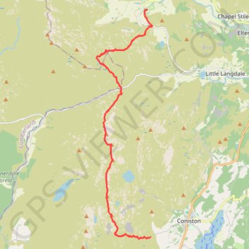
Sun Coniston to Great Langdale
- Distance: 14.6 Km
- Elevation gain: 999 m
- Maximum elevation: 796 m
- Elevation loss: 1,141 m
- Minimum elevation: 101 m
- Moving time: 4 h 38 m
- Moving speed: 3.1 Km/h
- Maximum speed: 12.1 Km/h
- Total time: 7 h 4 m
- Global speed: 2.1 Km/h
- Date: 28/04/24
Interactive map
GPS track profile
About this GPS track
Name: Sun Coniston to Great Langdale GPS track, route, trail
Coordinates: 54.36206 -3.13063 54.44237 -3.09704
Other GPS tracks
Click on a GPS track to view route, its statistics and profile.
2024-05-03 16:11:23
United Kingdom > England > Westmorland and Furness > Coniston
Distance: 9.0 Km • Elevation gain: 611 m • Maximum elevation: 756 m