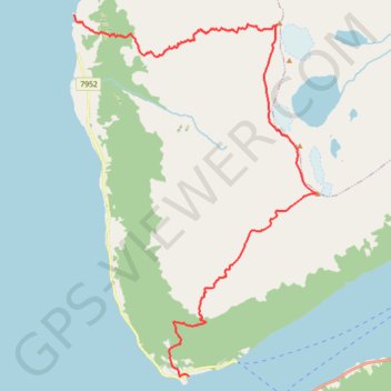
Norvège - Alpes de Lyngen - Uloya
Ski. En aller simple. #Ski
- Distance: 15.0 Km
- Elevation gain: 1,364 m
- Maximum elevation: 1,132 m
- Elevation loss: 1,365 m
- Minimum elevation: 0 m
- Moving time: 4 h 10 m
- Moving speed: 3.6 Km/h
- Maximum speed: 29.8 Km/h
- Total time: 6 h 23 m
- Global speed: 2.3 Km/h
- Date: 20/03/12
Interactive map
GPS track profile
About this GPS track
Name: Norvège - Alpes de Lyngen - Uloya GPS track, route, trail
End: 712, Vest-Uløyveien, Åsheim, Nordreisa, Troms og Finnmark, 9159, Norvège (69.84548 20.51751)
Coordinates: 69.78823 20.51751 69.84548 20.62887
Other GPS tracks
Click on a GPS track to view route, its statistics and profile.
Stage 1: Arctic Ocean to Väylä — European Divide Trail
Distance: 2,785.0 Km • Elevation gain: 23,823 m • Maximum elevation: 722 m