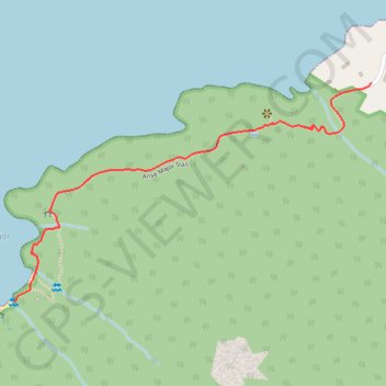
Randonnée - Anse Major Trail
- Distance: 3.7 Km
- Elevation gain: 189 m
- Maximum elevation: 82 m
- Elevation loss: 191 m
- Minimum elevation: 3 m
- Moving time: 44 m 13 s
- Moving speed: 5.0 Km/h
- Maximum speed: 5.4 Km/h
- Total time: 44 m 13 s
- Global speed: 5.0 Km/h
- Date: 01/01/10
Interactive map
GPS track profile
About this GPS track
Name: Randonnée - Anse Major Trail GPS track, route, trail
Start: Anse Major Trail, Bel Ombre, Seychelles (-4.61964 55.39656)
End: Anse Major Trail, Bel Ombre, Seychelles (-4.61982 55.39613)
Coordinates: -4.62627 55.38576 -4.61964 55.39656
Other GPS tracks
Click on a GPS track to view route, its statistics and profile.
Randonnée - Anse Major Trail
Distance: 2.0 Km • Elevation gain: 73 m • Maximum elevation: 82 m