Mountain Bike Ride Around Dunkeld, Perthshire Scotland
Loop MTB via Polney Loch, River Tay, Dunkeld Cathedral, Dunkeld Bridge, River Braan, Birnam, Ring Wood and Birnam Riverside Path. #MTB #Loop #Nature #Forest #River
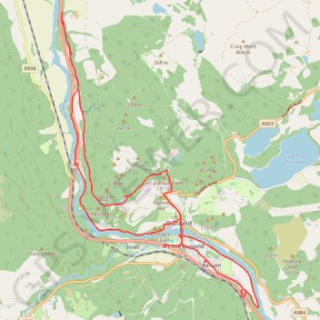
- Distance: 21.4 Km
- Elevation gain: 347 m
- Maximum elevation: 149 m
- Elevation loss: 347 m
- Minimum elevation: 48 m
- Moving time: 1 h 28 m
- Moving speed: 14.5 Km/h
- Maximum speed: 43.7 Km/h
- Total time: 1 h 51 m
- Global speed: 11.5 Km/h
- Date: 08/04/24
Interactive map
GPS track profile
About this GPS track
Name: Mountain Bike Ride Around Dunkeld, Perthshire Scotland GPS track, route, trail
Coordinates: 56.54950 -3.62644 56.60530 -3.55896
Other GPS tracks
Click on a GPS track to view route, its statistics and profile.
Walk over A9 bridge over River Braan by pedestrian pavement (sidewalk) and small diversion for SGN gas pipeline route then Fiddlers path
United Kingdom > Scotland > Perth and Kinross > Dunkeld
Distance: 6.0 Km • Elevation gain: 79 m • Maximum elevation: 76 m