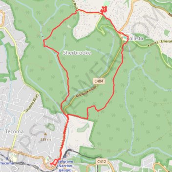
Belgrave > Grants > George Tindale > Sherbrooke Falls > Belgrave
- Distance: 11.6 Km
- Elevation gain: 357 m
- Maximum elevation: 499 m
- Elevation loss: 357 m
- Minimum elevation: 240 m
Interactive map
GPS track profile
About this GPS track
Name: Belgrave > Grants > George Tindale > Sherbrooke Falls > Belgrave GPS track, route, trail
Coordinates: -37.90934 145.35152 -37.87992 145.37140
Other GPS tracks
Click on a GPS track to view route, its statistics and profile.
Sherbrooke, Sassafras Creek, Alfred Nicholas
Australia > Victoria > Melbourne
Distance: 10.1 Km • Elevation gain: 361 m • Maximum elevation: 529 m